We offer a simple, transparent pricing structure, based on resolution and the size of your AOI. We normalize pricing and area minimums across providers to eliminate the need to negotiate commercial terms and manage contracts with multiple providers.
Free open data
Access open data sources at no charge. This allows you to prototype and test your application on 10m, 15m, or 30m resolution data, without incurring access or processing fees.
Pay-as-you-use
We offer the lowest AOI minimums in the industry, and deliver your data pre-clipped to your exact areas of interest, so you only pay for the data you need.
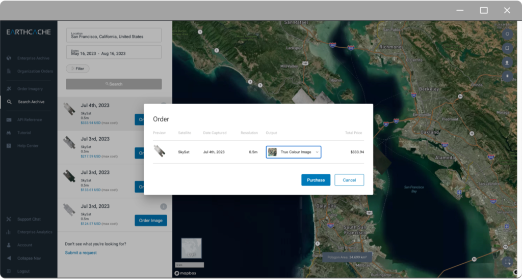
Satellite data pricing
Archive
Pricing
Previously-captured images are available in our archive and are usually available for same-day download.