

With over 400 imaging satellites orbiting our globe, never before has it been more affordable to obtain a bird's eye perspective of Earth. Consequently, analysts have taken full advantage of this access and created multiple innovative ways to utilize satellite images for something other than just its beautiful sight. Even though many industries are gaining advantages from the Geo Intelligence transformation, it is within the financial sector where satellite image analysis has the strongest influence. Here are 4 ways investors use satellite imagery to comprehend markets and assist in their continuous effort to outperform their rivals.
4. Predicting global commodity supply
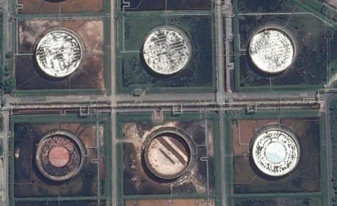
Have you heard of using satellite data analytics to estimate the volume of oil in storage tanks? This method was not possible just a few years ago, but thanks to technological and analytics tactics developments, it has become achievable. This kind of observation provides investors with more accurate and frequent reports, allowing them to make better-informed decisions even when faced with political turmoil and extraction technology changes. Not only that, but this method can be used to monitor other aspects, such as a mine site's stockpile build-up, the progress of a forestry operation, or crop growth on farms around the world. Ultimately, these insights have tremendous potential for reshaping investment strategies.
3. Measuring Economic Fluctuations
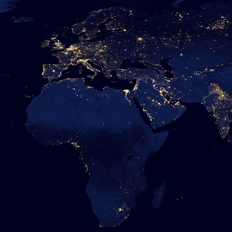
A single satellite image may provide interesting insight, but one must look at the bigger picture to reap the full benefits of earth observation. By tracking the evolution of infrastructure projects in places like China, nighttime activities in Ghana and maritime traffic off Brazilian ports, investors can gain valuable information about a geographical area’s economic climate. This data can inform decisions regarding potential investments and navigating the geopolitics thereof.
2. Projecting revenue at Big Box retailers
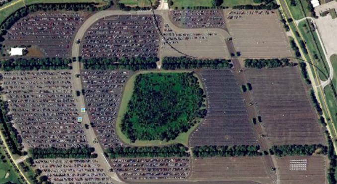
Counting cars in parking lots isn't a new idea, but using this method for multiple retail locations used to be impossible. Now, though, a single dataset of satellite imagery can deliver the same information that would have taken thousands of labour hours to obtain. Satellites can now recognize cars thanks to machine learning tech and 30 cm resolution images from 400 km up. This recognition enables us to monitor and analyze parking lot traffic for retailers like Walmart and JC Penny. It seems that fluctuations in this traffic closely reflect store revenue: investors with access to this data can make more informed decisions when planning for upcoming quarters and further into the future.
1. Tracking the progress of invested assets and their competitors
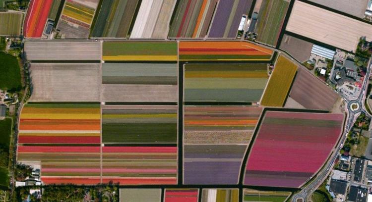
You can’t lie to satellites. This is a key advantage of utilizing satellite imagery when tracking the progress of an asset or creating a competitor analysis. After investing resources into a business venture, investors need to keep a close eye on their investments to gain maximum return at the optimal time. This analysis often relies on self-declaration from the asset in question, and although regulatory steps have been taken to try and reduce deception, there is always room for error. Instances like these make it beneficial for investors to take matters into their own hands and utilize satellite-based imagery for tracking. Through this method, investors can observe real estate advancements or compare data between competitors with relative ease — data that may have otherwise proven incredibly difficult or expensive to procure using traditional methods. Investors can use satellites to access a bird’s eye view of anywhere on Earth (even North Korea!). Additionally, this intricate level of detail also allows investors to look inside into things like foreign wheat harvests or European automobile production plants. Simply put, satellite imaging is revolutionizing how we approach international investing.
Over the past five decades, satellites have been observing our planet. Over those years, they have evolved from grainy images of faraway earth to augmented colour, high-resolution images. Combined with advances in artificial intelligence and machine learning, this imagery constantly improves our understanding of the changing planet. It is only now that investors realize this imagery's true value.